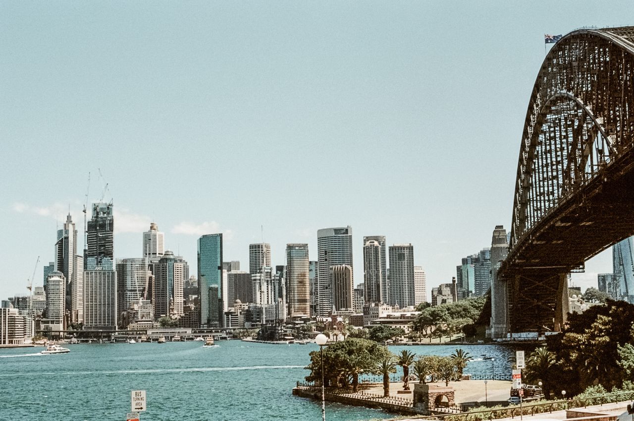
Sydney’s geography presents unique challenges for delivery routing, with coastlines interrupting almost every direct path, the CBD constantly decreasing the space cars can use, and a tunnel network with clearances that must be adhered to.
Adiona's route optimization software factors in these constraints specific to the Sydney metro area. For the national picture, read our breakdown of Australia's last-mile delivery challenges.
Routing obstacles around Sydney Harbour and CBD
Before we get to the obstacles, Sydney is Australia's largest city by population. It encompasses Sydney CBD, the North Shore, Eastern Sydney, Western Sydney, and greater Sydney regions like the Blue Mountains. These all contain unique geographies and rules. Here are some of the typical obstacles you'll see in any of the Sydney areas.
Tunnels
The Sydney Harbour Bridge for example has mass restrictions that keep most heavy vehicles off it entirely. That pushes truck traffic to the Sydney Harbour Tunnel instead, but the tunnel has a hard clearance of 4.4 metres, and NorthConnex has a limit of 5.1 metres. Any heavy vehicle over 4.3 metres falls under restricted travel conditions and has to stick to an approved road network. NSW has more low-clearance bridges and tunnels under 4.6 metres than any other state in Australia. Getting the height wrong means consequences that go beyond fines.
The NSW Government has ruled out closing the Harbour Tunnel to trucks specifically because rerouting that traffic through the suburbs would add up to 42 kilometres to the trip between Port Botany and the M1 at Wahroonga. That's the size of the detour a single wrong turn can force onto a fleet.
Weight restrictions
This is exactly why vehicle-specific routing rules are necessary in Sydney, they are the difference between a route that runs and one that ends with a truck wedged under a bridge on the news. A router needs a vehicle's real dimensions and needs to exclude it from any road it can't legally or physically use, before the driver ever sees the route. We tested this directly on a truck-versus-car routing experiment on the Hume Highway, and the results on why truck routing isn't just car routing with a bigger vehicle apply just as much to a harbour crossing as they do to a highway.
The CBD is getting smaller
While the harbour has always constrained routing, the City of Sydney has actively spent the last decade making the CBD itself harder to drive through. George Street has been progressively closed to traffic since 2015, first for light rail construction, then for pedestrianisation. The city's goal is a fully pedestrianised street from Circular Quay to Central Station, and the completed southern section alone reclaimed 9,000 square metres of former roadway for pedestrians.
Dynamic routing as a solution
For a delivery fleet, that's not a minor detour. Every metre of George Street pulled from the road network pushes delivery traffic onto parallel streets that weren't built to carry it, at the same time, the loading zones in those streets are getting shorter and more tightly enforced. A Sydney route optimised last year for a CBD drop might already be obsolete. This is where the "one route, forever" approach to logistics breaks down fastest, and where dynamic routing that can absorb a permanent street closure without a full manual replan is optimal.
Parking difficulties within Sydney
Finding somewhere legal to stop is a common route problem in Sydney. Loading zones in the city are short, tightly timed, and heavily fined, and inner suburbs like Surry Hills, Newtown and Paddington were laid out well before delivery vans existed, which means narrow streets, limited clearways, and a genuine shortage of places to park create challenges.
Radius Routing optimises routes for parking
We built Radius Routing directly based on this feedback. Instead of treating every stop as its own parking problem, it groups deliveries that can be walked from a single parking spot. In a suburb where the drive between two addresses takes ninety seconds but finding a second park takes five minutes, that reshuffling saves more time than any amount of distance optimisation ever could.
StarTrack Courier, who route across Sydney and the rest of Australia Post's national network, put a number on what this kind of optimisation is worth. Chris Cano, their National Business Improvement and Implementation Manager, described the shift plainly in our case study on route optimisation at StarTrack Courier: "If a run was not sequenced and unoptimised, we would just give it to a driver and say 'do your best.' Now, we look at an old route that took eight hours, see how it could be optimised, and do it in seven." Across 16,000 drivers nationally, an hour saved per driver per day adds up to 16,000 hours of extra productivity in a single day. A substantial share of that gain in Sydney specifically comes down to parking, not distance.
Left-hand driving turns right turns into a hurdle
It's easy to overlook because it's just how Australians drive, but left-hand traffic patterns matter enormously to routing math. Every right turn across oncoming traffic on a road like Parramatta Road or Oxford Street costs a driver real time waiting for a gap, and it's measurably more dangerous than a left turn. A routing engine that treats every turn as equal will hand a driver a route plan full of these crossings without knowing the consequences.
Routing platforms must be built for it from the ground up rather than adapted from a right-hand-drive market. Sequencing stops to favour left turns, and only crossing traffic when there's no better order to run the deliveries in, is a small adjustment that compounds across a full day of stops.
Western Sydney is a different city to route
Sydney's outer growth corridors, Western Sydney, the Hills District, the new airport precinct at Badgerys Creek, behave nothing like the inner city. Streets are wider, blocks are bigger, and parking is rarely the same constraint that it is closer to the harbour. What replaces it is distance. Drivers here cover far more kilometres between stops, which makes vehicle right-sizing and route density the factors that matter, not parking proximity.
Any fleet running both a CBD round and a Western Sydney round is really running two different optimisation problems under one banner, and a routing platform needs to treat them that way rather than applying one set of assumptions across the whole metro area. Territory design, not just stop sequencing, is what separates a route that works on both sides of the city from one that only works on one.
EV routing in Sydney
Sydney's EV charging network is still uneven; denser in the inner ring, and sparser the further out a fleet operates. Sydney's route planning constraints for electric delivery vehicles working outer suburban rounds. But the trade-off runs the other way in the inner city. EVs are quiet enough to operate during hours that noise restrictions would otherwise block, particularly in residential pockets of the Inner West and Eastern Suburbs. This opens up shift windows that a diesel van simply can't use. We cover this trade-off in more detail in how adding EVs to your fleet changes your route optimization options, and if you're planning a pilot, our six-step guide to testing electric delivery vans walks through how to avoid the most common reason EV pilots stall before they scale.
Delivering to Sydney businesses comes with its own rulebook
B2B delivery in Sydney runs on a tighter clock than most fleet managers plan for. Industrial estates in areas like Alexandria, Villawood and the Port Botany precinct often require booked loading dock slots, security clearance, and specific vehicle types, and missing a slot can mean hours of waiting rather than a quick drop-off. Combine that with concentrated 9-to-5 business hours and increasingly narrow customer-imposed delivery windows, and a Sydney B2B round has far less slack in it than the same round would in a smaller city. Getting this right depends on tracking the right operational metrics in the first place. Our guide to the top KPIs B2B delivery fleets should cover includes the on-time and dock-utilisation metrics that matter most here.
Construction as an ongoing barrier
Sydney Metro extensions, the Western Harbour Tunnel, ongoing light rail work, and general CBD redevelopment mean road access here changes more often than in most Australian cities. A route that was optimal in January can be wrong by February because of a lane closure nobody flagged. Static routes go stale fast in a city under this much construction, and fleets that can't adjust quickly end up either absorbing the delay or leaning on driver experience to route around it in real time, which doesn't scale past a handful of drivers.
Sydney last-mile delivery: frequently asked questions
Why is Sydney harder to route than other Australian capital cities?
Sydney combines a harbour that forces most north-south traffic through a small number of tunnel and bridge crossings, a CBD that's progressively closing streets to vehicles, and some of the tightest, most heavily enforced loading zones in the country. Most Australian capitals have one or two of these constraints. Sydney has all of them at once.
What's the height limit for trucks through Sydney's tunnels?
The Sydney Harbour Tunnel has a clearance of 4.4 metres, and NorthConnex is 5.1 metres. Any heavy vehicle over 4.3 metres is subject to restricted travel conditions and must use an approved road network rather than tunnels or bridges it isn't cleared for.
Does route optimisation software actually help with Sydney's parking problem?
Yes, but only if it's built to treat parking as a routing variable rather than an afterthought. Grouping deliveries around a single park, rather than optimising purely for driving distance between addresses, is what closes the gap between a theoretically efficient route and one a driver can actually run.
Is Western Sydney routed the same way as the CBD?
No. Inner Sydney routing is dominated by parking scarcity and loading zone time limits, while outer growth corridors like Western Sydney are dominated by distance and vehicle right-sizing. A single routing approach across both areas tends to under-serve one side of the city.
Sydney routing compared to other Australian cities
Sydney shares plenty with Melbourne, Brisbane and the rest of urban Australia: fuel cost exposure, driver shortages, tightening loading zone enforcement. But the harbour, the tunnel network, the CBD's ongoing pedestrianisation and the sheer gap between inner and outer Sydney mean a routing approach tuned for the national picture will leave real efficiency on the table here.
Try your Sydney route plans through our sandbox environment and see where the gains are.