The continental United States of America has an extraordinary variety in its geographical and topographical characteristics, making “route optimization” a highly dependent process. As we discussed in our overview of Australia’s last-mile delivery challenges, route optimization often includes individuals with deep personal history in a territory manually planning or editing a route to factor in what they know about the route’s challenges and shortcuts.
From rural farms, to mountain ranges, to deserts, cities, and sprawling suburbs, the continental US has it all. While the US does have dominant last-mile delivery suppliers by the likes of Amazon, UPS, FedEx, DHL, and USPS, there are still a large number of regional and specialty fleets.
We took a look at the top three largest cities and their unique last-mile delivery challenges to see what fleets are contending with when defining “route optimization.”
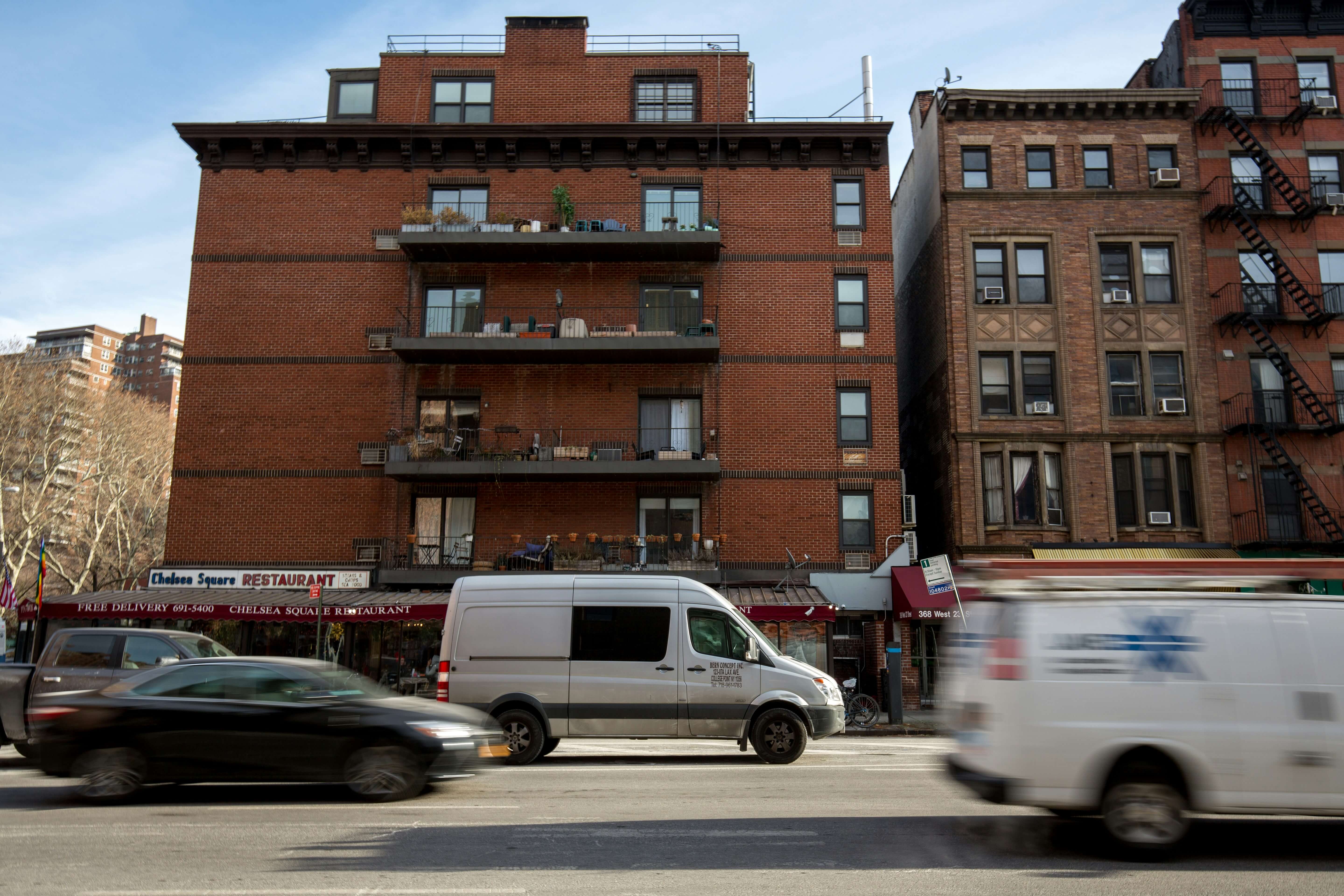
Route optimization challenges for New York City, NY
With a population of over 8 million, NYC is the largest city in the US. It’s so big, in fact, that we only took a look at Manhattan – each borough is distinct enough to need its own list! Here are the top factors to consider when optimizing a route in Manhattan:
Predictable city grid, but terrible traffic
When it comes to navigation, knowing where to go is easy thanks to Manhattan’s straightforward grid layout. Knowing how to get where you’re going in the most efficient route is less obvious.
Due to stop-start traffic, long roads and few diagonals to cut down distances, limited back alleys for off-street deliveries, and no roundabouts, routing quickly becomes complex.
Highly regulated
Manhattan has a number of regulations on vehicle size, weight, and height, bridge access, and even time-based restrictions that a route planner needs to account for. Parkways in particular have their own restrictions, including parts of Fifth Avenue, Park Avenue, and the Brooklyn Bridge. These are all central roadways with commercial businesses that may or may not have loading docks.
Routing considerations:
- A microfulfilment centre with a multi-modal fleet may alleviate the pain of some of the regulations and parking challenges
- Factoring in delivery window times and live traffic data will be essential for route optimization in Manhattan
Optimizing routes for Los Angeles, California
LA is half the size of NYC by population, but slightly larger by land area. The urban sprawl is one of the major differences that changes how routes are optimized, but far from the only one:
Steep terrain and the San Andreas fault line
The Los Angeles region has mountains and canyons, creating a varied topography that impacts the performance of ICE and electric vehicles. Rather than strictly looking at the mileage covered by a vehicle, accounting for the variances in altitude and inclines can provide optimizations that reduce fuel consumption too.
The San Andreas fault line introduces another routing challenge. In the event of a landslide or flooding, access roads may become blocked and disrupt routes. Dynamic routing that can account for this and keep your deliveries on track.
Urban sprawl and multiple activity centres
Unlike other cities, LA doesn’t have one distinct industrial area. Instead, it has multiple smaller zones, and lots of mixed use areas. Given how vast the region is, this is an opportunity to have multiple fulfillment centers that service smaller territories and benefit from shorter routing.
The urban sprawl goes hand in hand with LA’s notorious traffic congestion, often considered to be the worst traffic in the country!
Routing considerations:
- Choose between longer distance routes that travel along freeways, or shorter, more dense routes with smaller territories.
- Elevation changes and your fleet composition should be considered when optimizing routes
- Delivery time windows may be impacted by city regulations
Chicago’s unique route optimization considerations
From canyons and deserts to heavy winter snowfall – Chicago has almost the opposite topography and climate to LA.
Purely mathematical optimization is not always applicable to real-world applications, there are just too many factors (including human preferences, which aren’t always optimal.) Chicago gets close to it with its flat topography, excellent grid layout, and logical street address system.
The optimization challenges instead lie in its climate.
Heavy snowfall and parking restrictions
Chicago’s cold winter climate impacts both EV and ICE performance. On top of that, snowfall impacts parking in more ways than one.
During winter months, there are early morning parking restrictions so that streets can be plowed before the day starts, however this will disrupt any deliveries that require street parking.
Other regional considerations for route optimization
Outside of the three cities we’ve covered, there is still a lot more variation across the continental United States. For example, Phoenix has extreme summer heat and driver safety is a major concern. Timing deliveries to be made during cooler hours of the day, and fleets that prioritise air conditioning may be optimization factors for some months of the year.
Some cities have emissions-based restrictions for certain zones. For example, Santa Monica has three ZIP codes with a voluntary zero-emissions delivery zone. New York City has congestion pricing, and plans to pilot low-emissions freight zones by 2027.
Partnering with the right route optimization technology
Not all route optimization is made equal. Flexibility to favour different factors when planning routes is crucial to getting routes that actually work and drivers enjoy. Try it for yourself with two weeks of full access to Adiona’s FlexOps platform. Sign up here and use your real routing data to test our optimization engine.